


18th to 28th August 2003
|
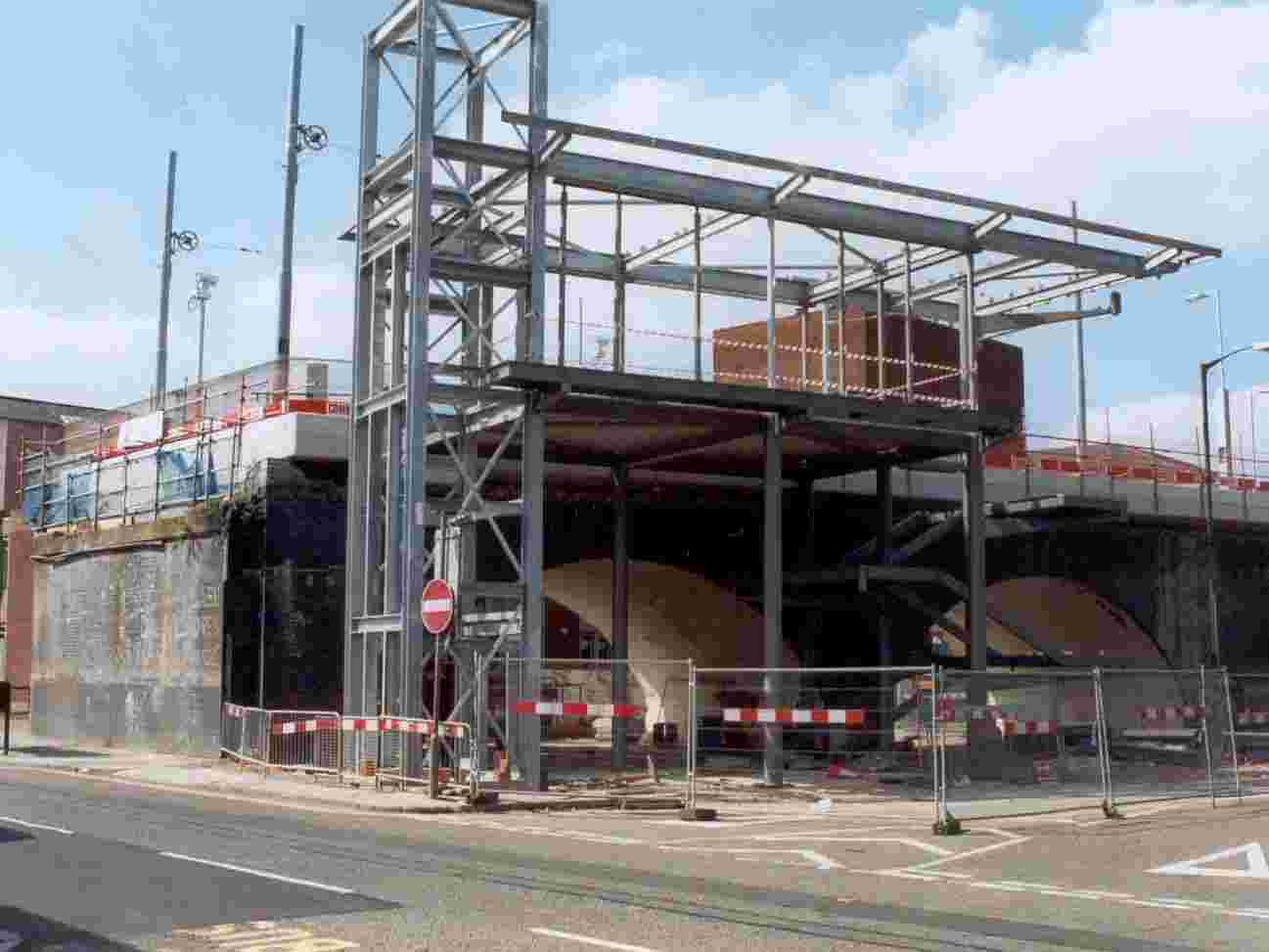
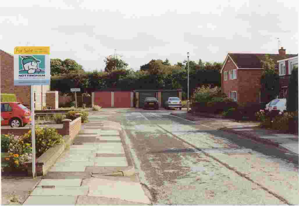
1. The emerging tram stop buildings at Station Street. Here the Phase II network extensions to Chilwell and CW begin. |
|
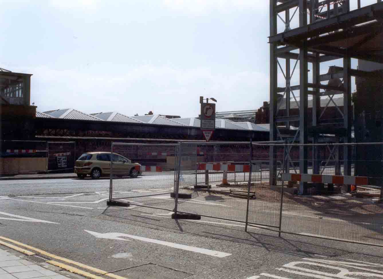
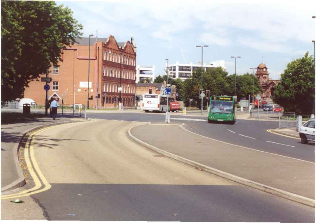
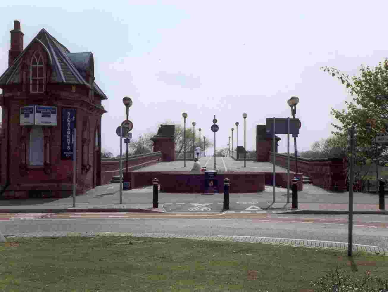
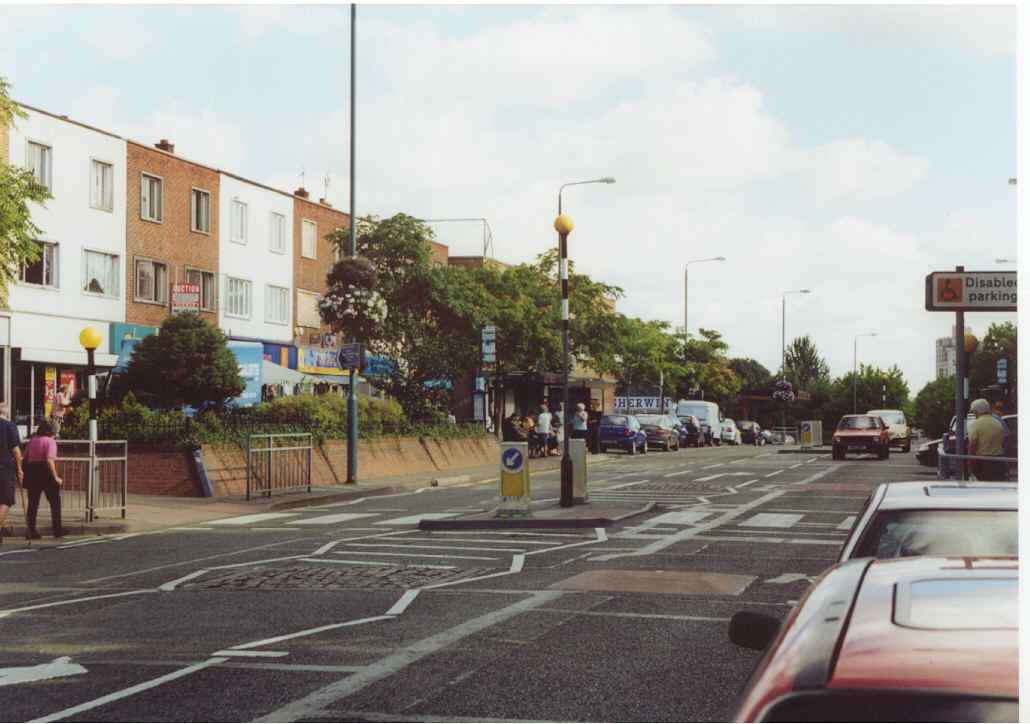
2. Nottingham station, as viewed from the junction of Station Street and Trent Street. The Phase II line will cross over the railway station on a viaduct, following the alignment of the former Great Central girder bridge, itself demolished in the 1980s. |
|
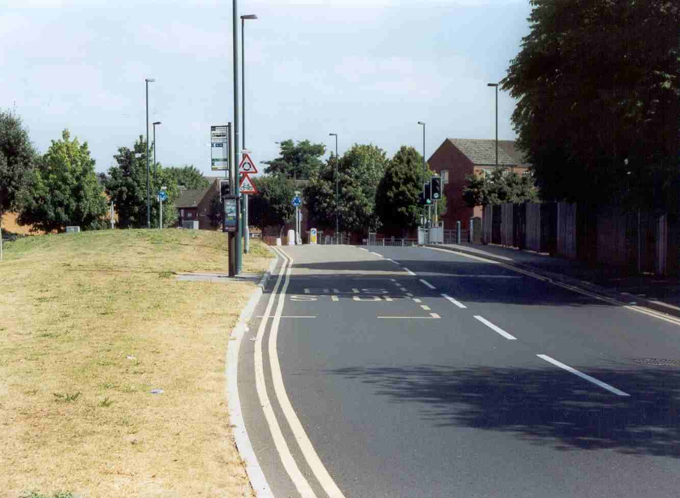
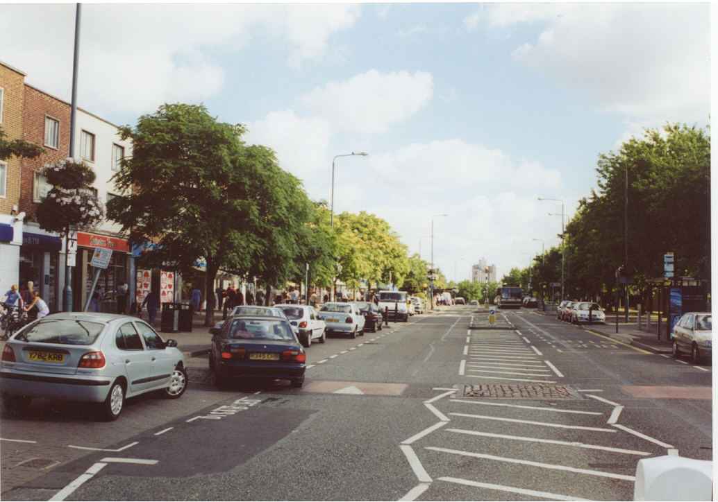
3. From Queens Road, looking north at the railway station. At this point a high-level tram stop will be built, having same-level interchange with the station via a new concourse. |
|
4. From Queens Road, looking south. The new line will cross the road via a high-level bridge. |
|
5. The crossroads of Arkwright Street and Crocus Street, looking north-east. The tramline will descend to ground level next to the Crown pub, and cross the streets on the level. |
|
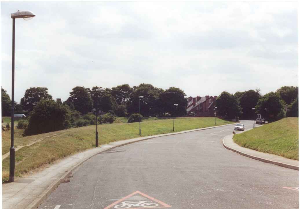
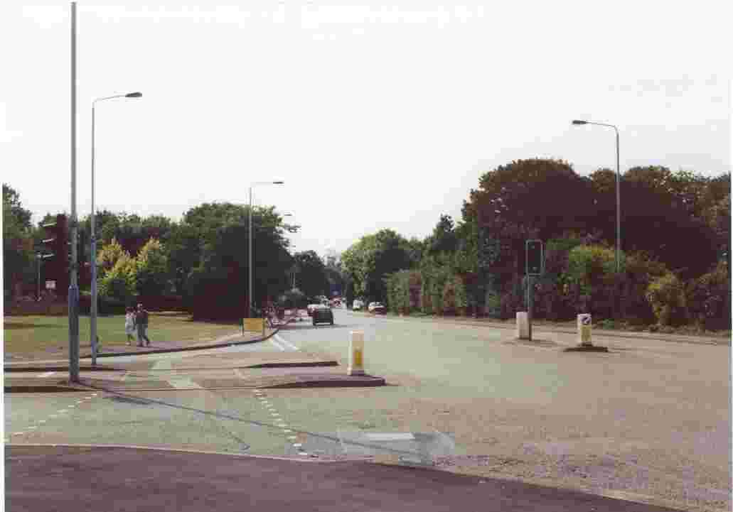
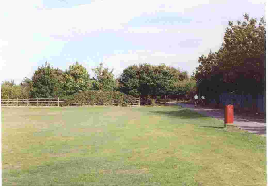
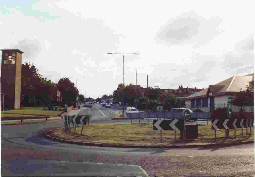
6. Looking west towards the current mini-roundabout junction of Meadows Way, Sheriff's Way and Queens Walk. This is the future tram junction of the Chilwell amd CW routes. |
|
7. Looking east towards the junction of Meadows Way and Queens Walk. |
|
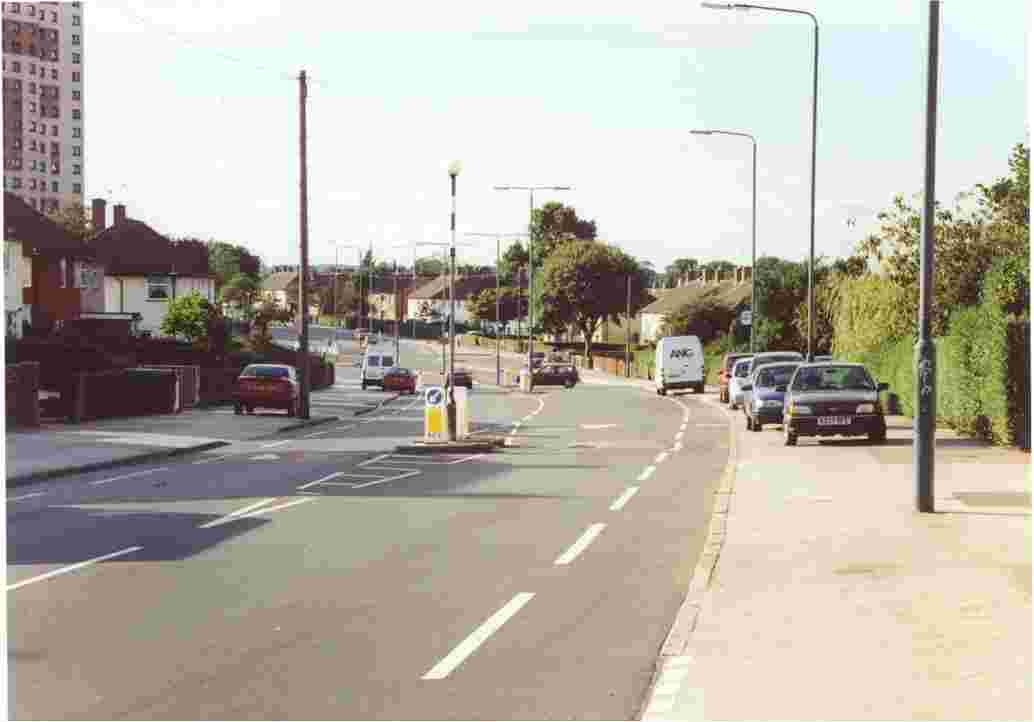
8. Looking north towards the junction of Meadows Way and Queens Walk. The clock tower of Nottingham station is visible. |
|
9. Looking south down Queens Walk. The tram stop for Meadows centre will be located a few yards along in this scene. |
|
10. Queens Walk, looking north from the roundabout next to Wilford toll bridge. The Queens Walk tram stop will be located just to the left. |
|
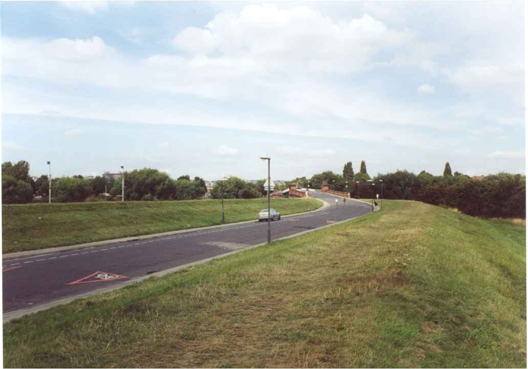
11.Wilford toll bridge, as viewed from the same location as the previous photograph, but looking south. The current road roundabout will be deleted for the passage of the CW tram track, which will then cross over the bridge. |
|
12. Again looking south at Wilford toll bridge. Opened in 1870, the bridge tolls were abolished in 1969,and vehicular traffic ceased 5 years later. The bridge itself, a Grade II Listed Building, was rebuilt 20 years ago. The current bridge carries only pedestrians and cyclists, and will be widened for the CW tram track. |
|
13. Wilford toll bridge, looking south-west. The original approach and buttresses remain. The steel structure will not require much strengthening to carry the tramline. |
|
14. Looking north towards Wilford toll bridge, with flood defences astride Main Road. The carriageway will be converted to the CW tram track, and the tram stop for Wilford village will be in the foreground. |
|
15. Looking south from the toll bridge towards Wilford village. |
|
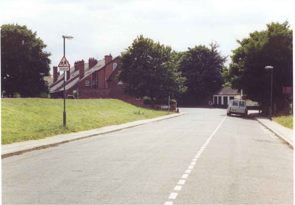
16. Again looking south along Main Road. The Ferry Inn is just behind the tree on the right The tram stop for the village will replace the carriageway. |
|
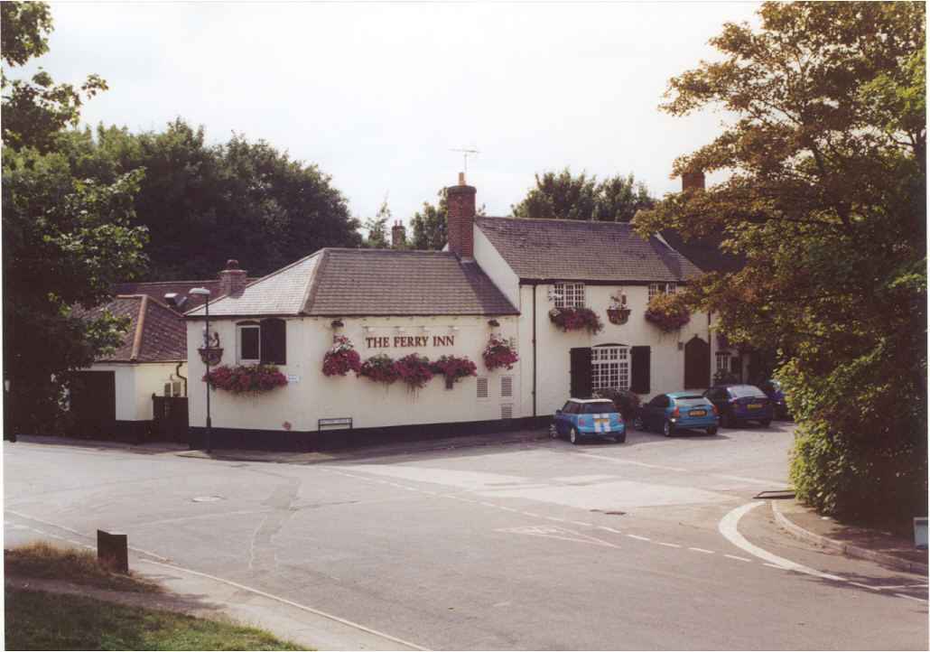
17. The Ferry Inn, Wilford village. The tram route will be in the foreground, and on a right-angle bend. |
|
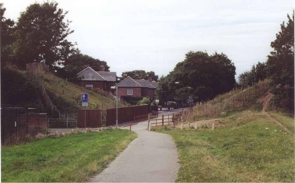
18. Looking east from Main Road, with the Ferry Inn behind the viewer. Behind the trees is Coronation Avenue. The existing floodbank along the Avenue will be lowered to street level and the tram track will be placed on this surface, not the road carriageway. A new flood retaining wall will be constructed. |
|
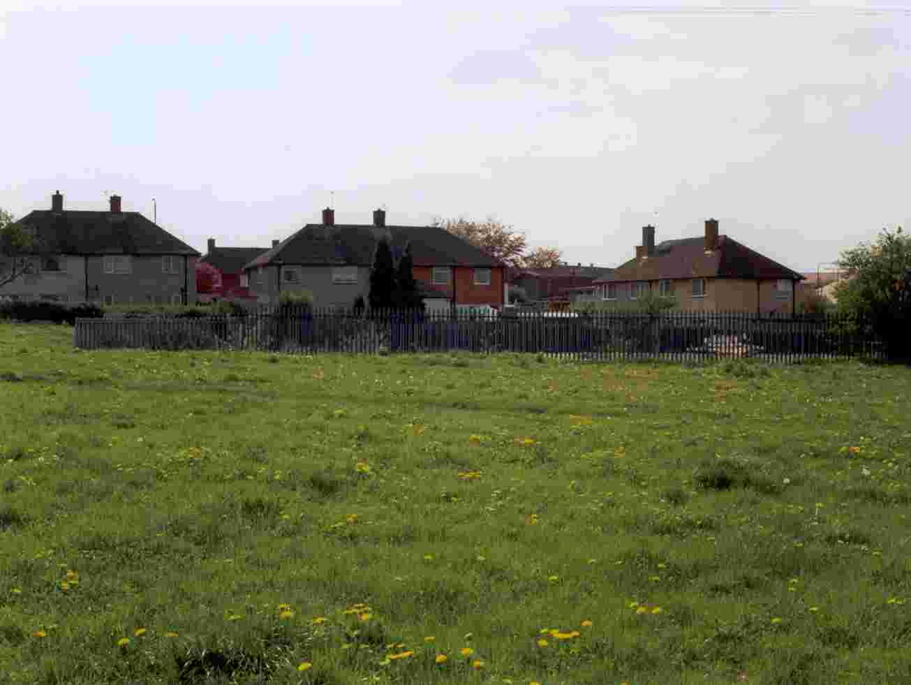
19. Again looking east from Main Road, into Coronation Avenue. The tram track will be behind the trees. |
|
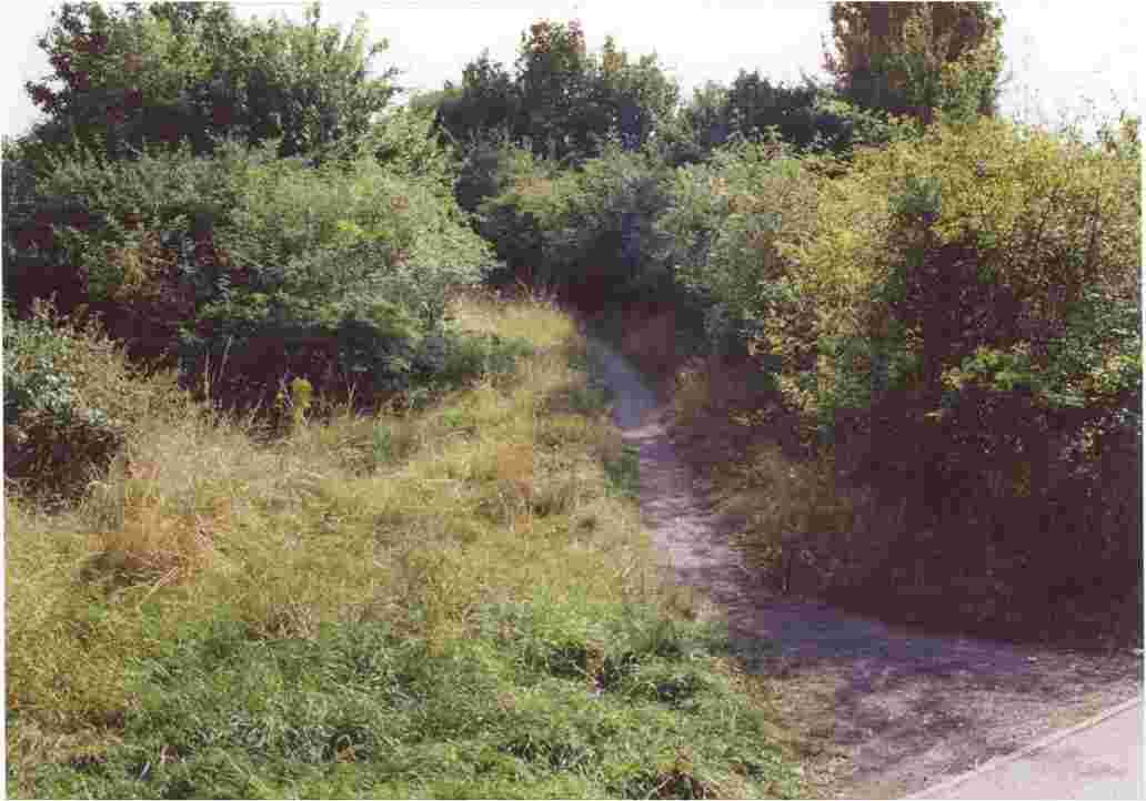
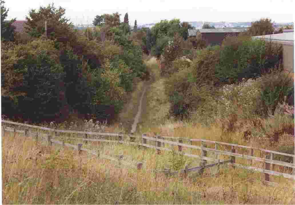
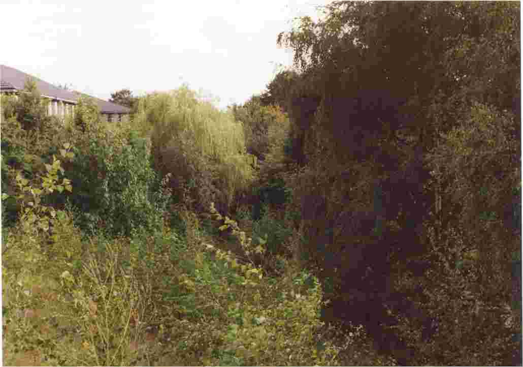
20. Iremongers (or Ironmongers)Pond, looking north towards the Trent and Nottingham. The widening of the flood defence to take the tram track will have some impact on the pond and its wildlife. |
|
21. Looking west towards Coronation Avenue, from the Trent footpath next to the Emanuel C of E secondary school. Here Wilford embankment was breached in September 2001 when a small bridge was demolished. The tram track will come off the lowered floodbank parallel to the Avenue, turn south at a right-angle bend, cross the school access road shown here on the level, and rise up to the old railway embankment on a ramp on the school side. |
|
22. Looking south from the access road to the school. The school playing fields are on the left, and Wilford embankment north is on the right. The tram track will rise up a ramp to embankment level, so the footpath and trees on the left here will be replaced. |
|
23. South of Vernon Avenue is a small railway bridge surviving on embankment north. The trees on the left will be untouched, since the tram ramp will be on the other side. The bridge will carry the tramline. |
|
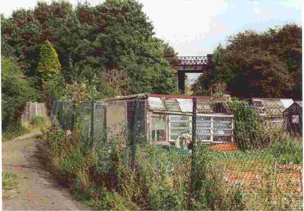
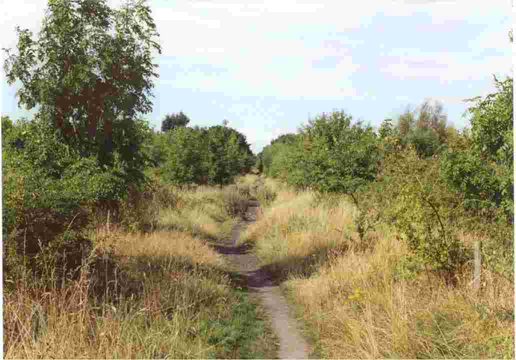
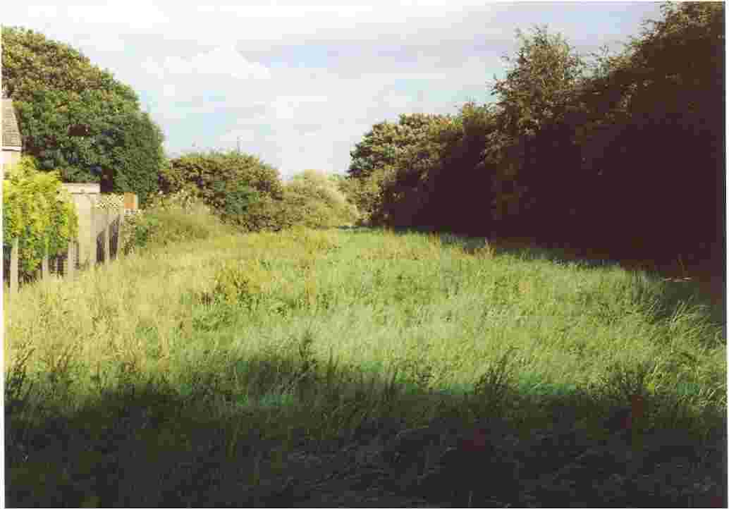
24. Looking southeast across Klondike allotments, in Wilford village. The line of trees at the far end marks the overgrown embankment, and the tram track will run on top of the embankment lowered by about a metre. |
|
25. Embankment north covered in vegetation. Looking north from Wilford Lane, on the West Bridgford side. |
|
26. Wilford Lane, looking west from its junction with the Compton Acres road. The embankment, at right angles to the Lane, is covered in trees. Embankment south, to the left, will be demolished to ground level, and the Wilford Lane tram stop will be located just behind the temporary yellow sign for road works. |
|
27. At the Wilford Lane/Compton Acres road junction, looking south into Compton Acres. This large upmarket housing estate was built 1985-91 in several stages.on the Rushcliffe Borough side of the former railway embankment. |
|
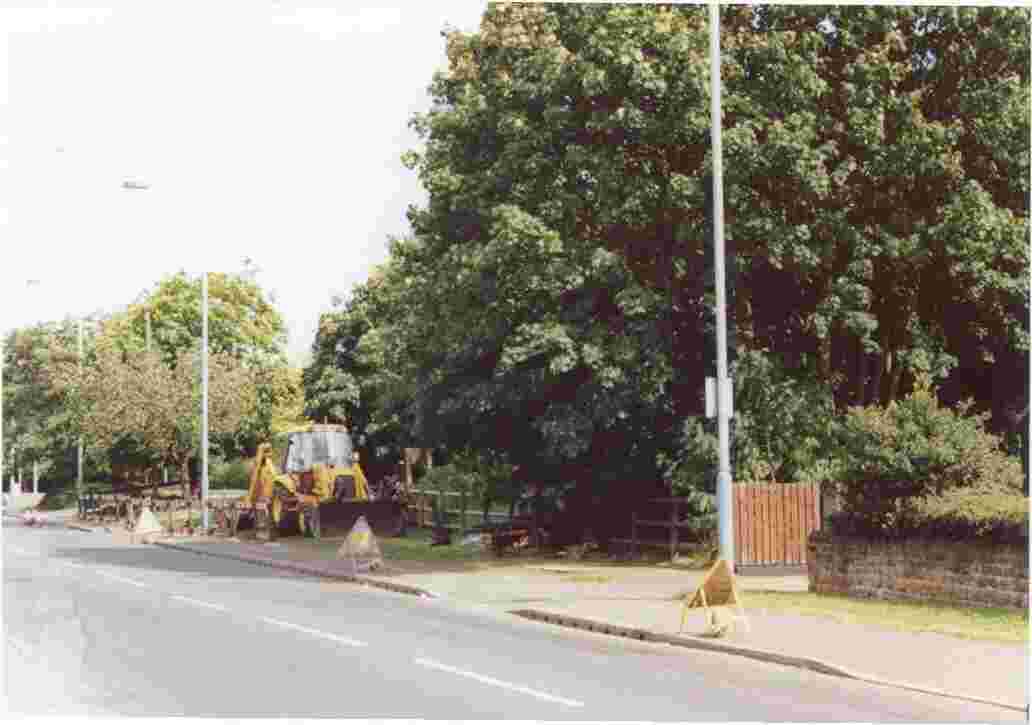
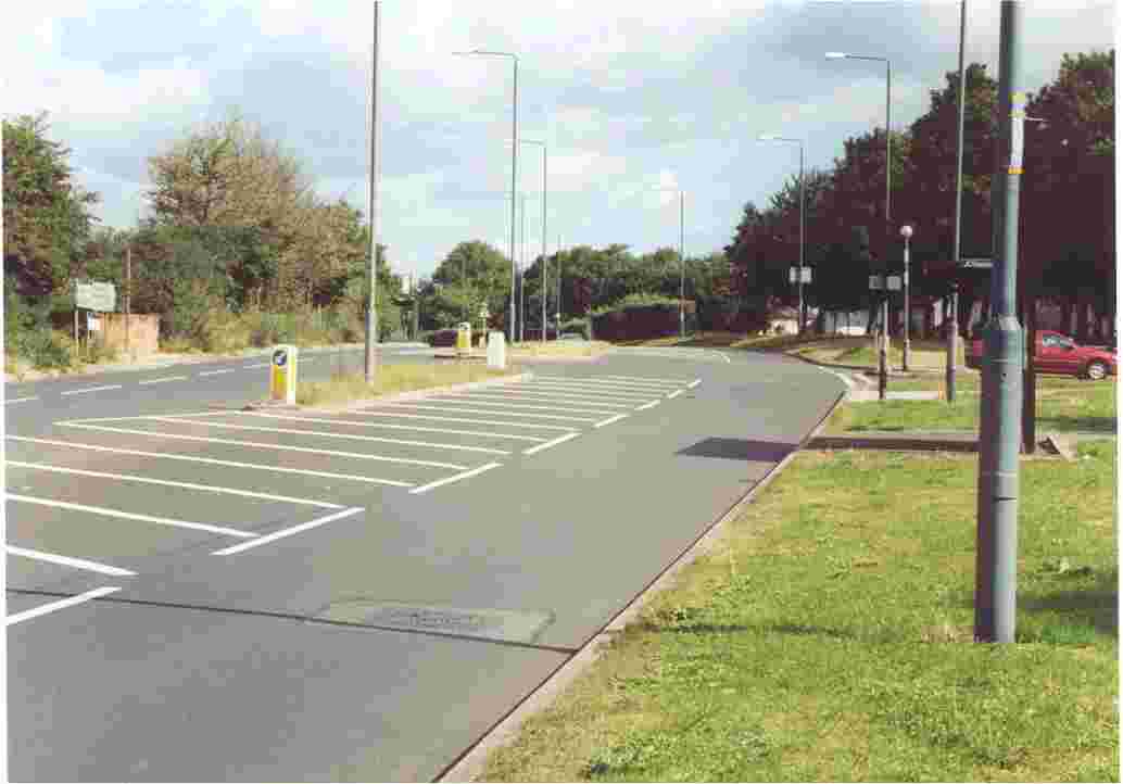
28. From Wilford Lane, looking at the start of embankment south. A notice board and steps up to the embankment top exist next to the digger. The large tree will be removed, and a tram stop built at ground level. |
|
29. At the top of embankment south, just beyond the steps up from Wilford Lane. |
|
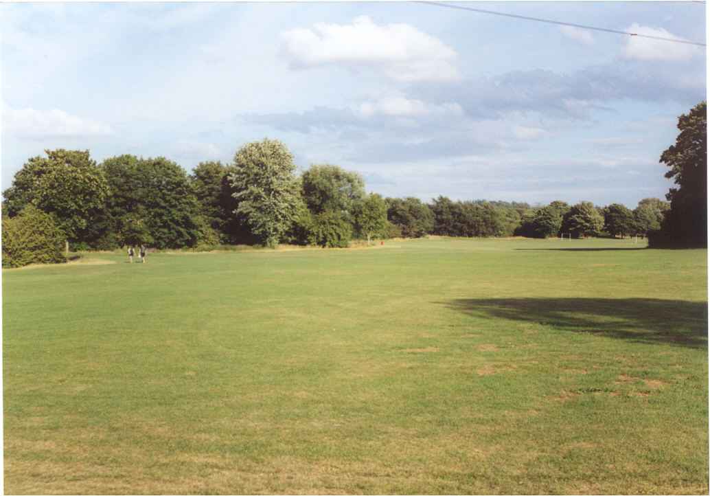
30. Looking north along embankment south, close to the footpath linking Ruddington Lane recreation ground to Compton Acres. The embankment is low at this location. |
|
31. Embankment south, as viewed from the recreation ground on Ruddington Lane.The tram track will cross the footpath on the level, and Compton Acres tram stop will be located here. |
|
32. From the Wilford to Compton Acres footpath, a view south showing the path to the southernmost end of the embankment, much overgrown. Compton Acres tram stop will be located here. |
|
33. The Wilford-Compton Acres footpath from the Compton Acres side, Ascott Gardens. |
|
34. A view from Acorn Bank, Compton Acres. Next to the lamp standard, the rusting ironwork of the railway bridge over Greythorne Dyke is just visible. |
|
35. Looking north from the former railway bridge on Ruddington Lane. The bridge was shored up with earth, and its parapets removed, in 1992. An industrial estate is on the right, built 1972-3. The site was formerly a brickworks, its sidings controlled by a signal box which once stood on the left of the railway track. Just visible is a service bay plaform jutting out from the estate onto the railway trackbed, the only property demolition intended for the tram route in the Wilford area. The Ruddington Lane tram stop will be located here. |
|
36. Ruddington Lane former railway bridge, looking south. Just visible is the business park on Ruddington Lane. |
|
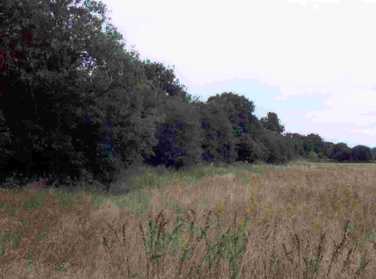
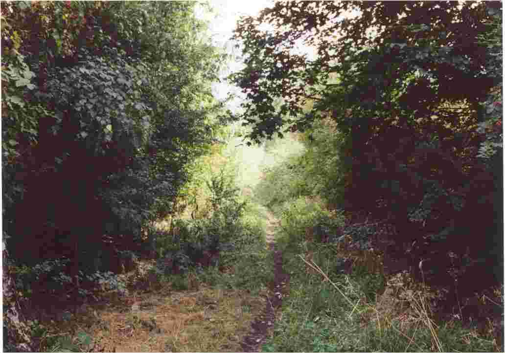
37. The railway trackbed in cutting, looking north from Wilwell. The lamp standards of the A52 ring road are just visible. The tram track will run underneath the disused railway bridge on the A52, proceed for a few yards in the cutting, then curve sharply west over the fields to Clifton. This short overgrown cutting is part of Wilwell nature reserve, but the tramline will not cross the SSSI boundary further south. |
|
38. Again looking north from Wilwell, the tram track will leave the old railway cutting and cross the fields near these dwellings, mostly bungalows. |
|
39. The bungalows are on The Downs, Silverdale, built 1959. NET will provide a fresh 10 acres site for recreation and wildlife to compensate for some loss of the ecology of Wilford embankment. |
|
40. Continuing west, the tramway will cross Fairham Brook and enter Clifton estate, a tower block of which is visible in this scene. CW YES! would like an extra tram stop provided for Silverdale, in the new woodland to be planted by NET, which would screen this view of the housing. |
|
41. A view of Waingrove, a cul-de-sac on Silverdale. To accommodate an extra tram stop for the estate, pedestrian access could come this way, involving the demolition of a couple of the garages at the end of this road. |
|
42. Between the rear of Waingrove and Fairham Brook exists this narrow open space corridor, which could be a site for a tram stop in the southwest corner of Silverdale, subject to some track realignment. |
|
43. Clifton fields, as viewed from Silverdale Walk, the footpath linking Silverdale to Clifton estate. The trees are along Fairham Brook. The tramline will bridge the stream and then cross the fields, right to left in this scene. |
|
44. Looking northeast along Silverdale Walk towards Silverdale. The tramline will cross this footpath from right to left. |
|
45. Looking west towards Farnborough Road from Silverdale Walk. Two houses in the distance will probably have to be demolished. |
|
46. Farnborough Road, looking northwest towards the roundabout with the northern end of Southchurch Drive. The CW tram route enters the on-street section here. |
|
47. Looking south down Southchurch Drive towards the first tramstop on Clifton estate (Southchurch Drive North). |
|
48. Southchurch Drive, from the junction with Varney Road. The tram stop will be located next to the shops. |
|
49. The junction of Southcurch Drive and Rivergreen, looking south. The Rivergreen tram stop will be located here. |
|
50. The main shopping centre of Clifton estate, looking south. |
|
51. The main shopping centre of Clifton estate, looking north. The tram stop for Clifton centre will be located here. |
|
52. The main shopping centre of Clifton estate, looking north. |
|
53. The southern end of Clifton, with the tower of Holy Trinity church, giving its name to the tram stop, which will be located near the shops on the right. |
|
54. Farnborough Road, at the south end, looking east. Summerwood Lane is on the right, giving its name to the tram stop to be located in the middle of this scene. |
|
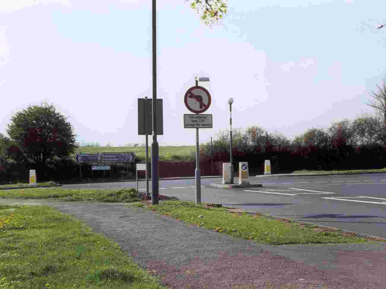
55. The road from Gotham, as it enters Clifton, looking north. The tramline will come out of Farnborough Road on the right and cross the Gotham Road on the level. |
|
56. Looking west from the Gotham Road, the tramline will enter the Green Belt here for the park-and-ride facility with 1,000 spaces. Over 600 homes may be added in future to Barton Green, to the north. |
|
57. The tram route terminus, Mill Hill, further down the road to Gotham. There will be new bays for South Notts buses here. The car park will have a slip road from the A453, and be screened from Clifton pastures. |
|
58. Mill Hill, looking north from the future car park southern boundary. |